Historical Washington State Maps
Home
New From Kroll
Standard Publications
Central Business District Maps
Seattle Maps
Puget Sound Maps
Regional Maps - State Maps
ZIP Code Mapping
Custom Wall Maps: Arterial Maps, Street Maps and More
Historical Maps
Kroll Atlases
Township Maps
Recorded Plat Surveys
Mining Claim Maps
Historical Seattle Maps by Kroll
Historical Puget Sound Maps
Historical Washington State Maps
Historical Alaska Maps
Miscellaneous
Custom Cartographic Design
Technical Services for GIS
General Mapping/Graphic Services
Seattle Area Digital Aerial Photos
About Kroll
Map/Directions
Contact Us
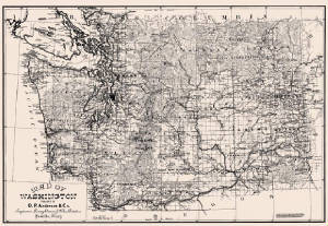
Anderson's Washington State Map approx 2 x 3 feet - $39.95
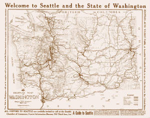
Kroll's Washington State Map circa 1912 - approx 2 x 3 - $39.95
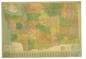
Kroll's Washington State Map 1924 - 2 x 3 - $39.95
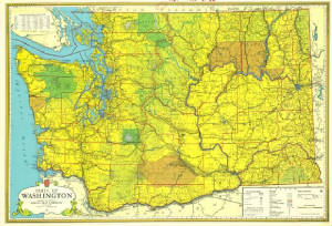
Kroll's 1970 Washington State Map 2 x 3 - $39.95
Return to Kroll Home Page