|
We recently completed
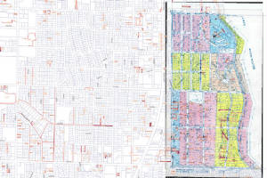
a year-long project with Seattle City Light - mapping approximately 10,000 easements within the service area that includes
all of the City of Seattle and the adjoining municipalities of Shoreline, Burien, SeaTac, and areas within the City of Renton.
The spatial data that we created is multi-use, crossing platforms of both GIS and CAD environments.
|
|
Initially we scanned hundreds of original plat maps (Kroll
Maps from the 1980's), and carefully correlated each image to the more accurate City of Seattle GIS Parcel Base. Each
image was exported as a by-product with the appropriate World File correlation, for easy future reference, or insertion in
CAD or GIS.
|
|
|
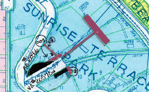
Countless judgment calls in terms of annotation and placement
were necessary during the process of vectorizing the easement information. The fact that we have worked with parcel
mapping for many years proved beneficial to the interpretation of the hand-drawn notations. An efficient dialogue was
established with the City Light staff to resolve ambiguities.
|
|
|
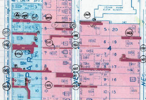
The closed polygons were assigned critical information
in the appropriate data fields using AutoCAD Map. Those data fields, along with the newly created polygons, were converted
into Shapefiles for use in the Seattle City Light GIS.
|
|
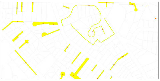
This new spatial data layer will allow SCL to finally
archive the hard copy reference, enable them to reference the original map document in real-world coordinates, and establishes
a new electronic standard for viewing, sharing, and revising their critical easement information. SCL may decide to
hotlink the original easement information to the vector representations for verification of legal information.
|
|