|
|
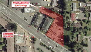
High resolution aerial photos make compelling courtroom
displays, especially when those images contain your specified highlights and annotations which assist in communicating your
key arguments. This example highlights an area of interest to the case, as well as posting text critical to the successful
argumentation of the case. We also have archived select groupings of historical aerial imagery - please inquire.
|
|
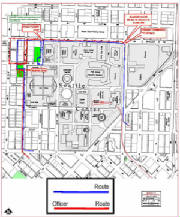
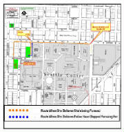
Successful litigation often involves graphically
displaying routes in relation to time of occurrence. We have numerous existing map bases that can be customized and
enlarged for your courtroom display that will exhibit this clearly.
|
|
|
|
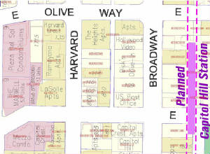
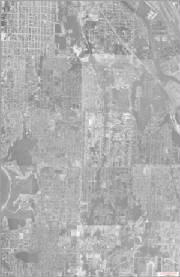
Our largest scale mapping, and most detailed mapping
offers you a great base map for your custom layer highlights. Kroll's Integrated mapping represents a perfect base from
which you can discuss property values, proposed transportation features, or condemnation suits.
|
|
Litigation often has a spatial component - Our mapping
and ability to understand your needs can make the difference in your case. Using existing base maps and/or aerial imagery,
we can promptly assemble a communicative map graphic that will help you effectively argue your case.
|
|
|
|

|
This job required geo - referencing (in order to make
determination on addresses) black and white aerials from the 1960's and plot locations by business type. Maps
were plotted out to 4 x 6 feet for courtroom displays.
|