Emergency Services - Security Mapping

webassets/Street_Quads_with_Feb_2008_Beats-with_composite_precints-EAST_AND_WEST_PRECINTS_-_15_x_18__2_.JPG

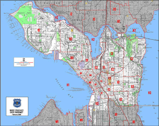
Upon conversion of the Seattle Police GIS files, Kroll compiled custom Police beat layers correlated to our traditional street map view (as well as our more detailed Integrated Mapping).  Our street mapping provides the Police a static and reliable cartographic view that illustrates all the information they need, at once (e.g., block numbers, schools, parks, one way streets, neighborhood names, etc.) combined with their boundary and beat names.  This information was prepared as laminated maps, by precinct, wall maps, and also in custom atlas form.

webassets/SFDsamp.jpg

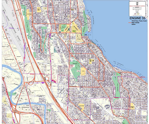
The Seattle Fire Department - Engine 33 in South Seattle, uses a custom set of data highlights that depict preferred arterial routes, fire hydrant locations (easily coverted from GIS point files), and displayed road classifications. 

webassets/Security.jpg

Whether it is security planning for a major event, or strategic planning for for a visits from international dignitaries, we have provided the reliable base maps that enhance those public safety endeavors. 

webassets/aerialwithimtext.JPG

Custom overlays on scaled aerial photos are an effective mechanism for communicating security-public safety plans.

webassets/Lifeflight.JPG

LifeFlight is an emergency air transportation company and they needed mapping that ilustrated Base Locations and Hospitals.  Those locations were supplied to Kroll in spreadsheet form with latitude and longitude coordinates.  A terrain backdrop was requested on their final map graphics.

Return to Kroll Home Page