|
MAPPING FOR BUSINESS AND MARKETING
ZIP Code maps are essential tools for
your marketing endeavors. They can help you define your market and clarify your business territories. Kroll has
several levels of mapping detail from which to choose, all available with up-to-date ZIP Codes. We
can custom-plot any area to satisfy your coverage needs.
| MAPPING FOR BUSINESS AND MARKETING |
|
|
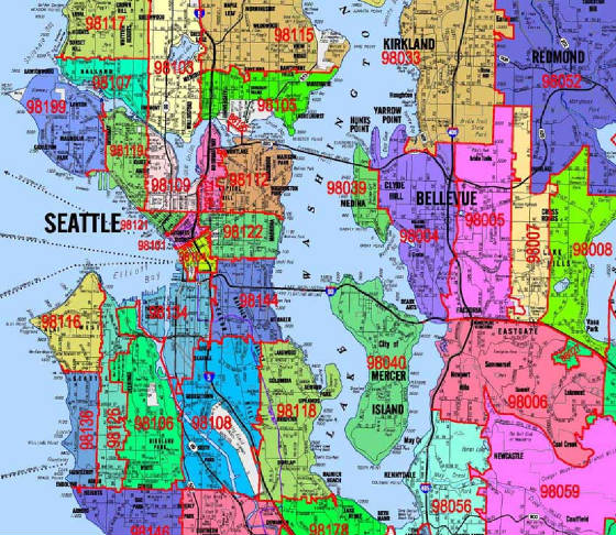
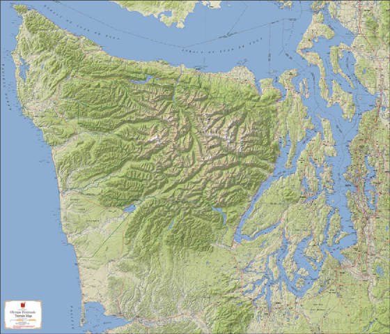
| ZIP CODE OVERLAY ON KROLL'S METRO SERIES MAP |
|
Marketing
General Business
Mapping for Government
Emergency Services - Security Mapping
Real Estate
Waste/Recycle
Law Firms
Event Planning
Homeowner's Association
Custom Maps for Your Web Site
Telecommunications
Mapping For Utilities
|
| |
|
MAPPING
FOR REAL ESTATE AND PLANNING
Kroll's continuously expanding map coverage is used
daily in the real estate industry. Our detailed mapping is an excellent tool for planning and engineering purposes; it's
structured to facilitate data exchange between our mapping and GIS applications.
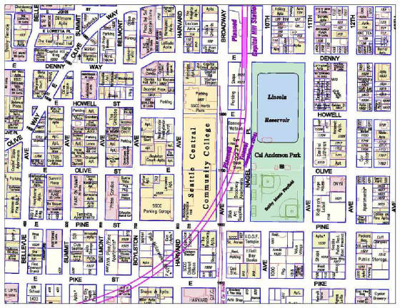
CUSTOM MAP GRAPHICS Our custom maps communicate exactly the ideas you want to convey, beautifully and accurately. Kroll
blends electronic publishing with CAD and GIS to create one-of-a-kind maps that are perfect for presentations and company
literature - even downloadable web graphics. We've created maps that show directions to a local Belltown coffee shop,
a resort lodge in Nebraska, proposed hydro facilities in Burundi, Africa - and everything in between. Please
visit our Custom Cartographic Design page to view a wide variety of map graphics we have created for some of our clients.
|
|
LET US REPRESENT YOUR DATA Kroll base maps are the perfect vehicle to display your information. Your current sites,
your potential locations, your competitors' locations, your boundaries - all take on a unique visual perspective when represented
on our maps. We have thousands of proprietary layers on file that are maintained
for numerous agencies and individuals.
|
|
|
GREAT CARTOGRAPHY
Using the latest technology, we offer multi-layer maps that are the gold standard in the greater Seattle
area. Choose from our existing publications, or consider the inexpensive option of a custom plot with your choice of
layers, sizes, and finishing options.
|
|
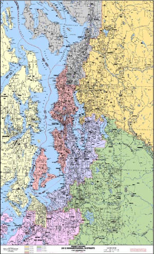
MAPPING
FOR GOVERNMENT We provide mapping services
to all levels of public organizations, from school districts to city park departments to the federal government. A common
request involves the interpretation and representation of boundary information which we can map accurately and clearly for
you. 2012 Congressional Districts are depicted on this detailed base
map.
|
|
| 2012 Congressional Districts |
|
|
| |
|
| |
|
| |
|
|